A Whiteparish local history page from younsmere-frustfield.org.uk
Notes: See working notes for further information and analysis. Pages on other sites to the south, Whiteparish Garage and the Pound, Poundside Cottage and Jewsons, may be of interest if you are reading this page. Not all links shown on this page are available publicly.
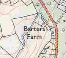
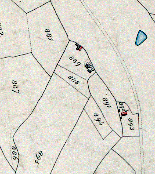
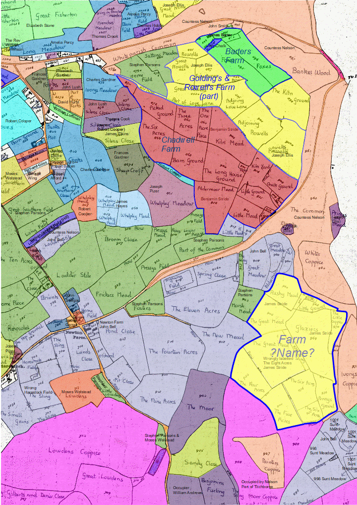
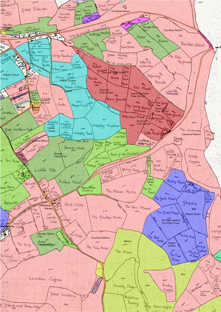
Barter's farm lies near the Southampton Road end of Common Road, on the right as you leave the village and almost at the most southerly point of Whelpley Manor. Sections of the 1842 Tithe Map, coloured to show owners and occupiers, can be seen below, with Barter's Farm located at top right. The full maps can be selected from 1842 Tithe Map, with quick access to wider views of the area around Barter's Farm at occupiers and landowners. These maps all have north to the left and east at the top, as on the original. [Know Your Place gives access to a digitised copy of the full map and the list of awards, but is not coloured in this way.]
In 1842 James Barter owned three parcels along the road: 889/890 House Garden and Orchard, and 891 Orchard, and occupied a further three parcels owned by George Yalden Fort that lay behind the house, these being 894 Garden, 895 Foxes and 896 Foxes, both the Foxes fields being pasture at the time. 889 and 890 he shared with Levy Chalk: see below for more details. The maps below show the area, with occupiers on the left (James Barter occupier bright green) and landowners on the right (James Barter landowner Magenta).
Note also the blue parcel 888 Part of Foxes, used as a garden by Levy Chalk and again owned by George Yalden Fort. Immediately south on Common Road are two houses 892 owned by Countess Nelson and occupied by John Smith the Younger and John Smith the Elder. This is where Poundside Cottage stands today.
.jpg)
.jpg)
Left: Land occupied by James Barter --- Right: Landowners for the same area (North to the left)
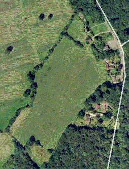
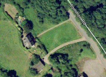
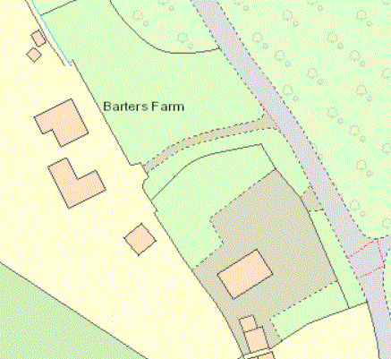
The modern view of the farm below (2002, north at the top) shows a recognisably similar layout, with the two Foxes fields still clear, woodland having encroached into the southeast corner across the end of 896. The garden 894 is now incorporated into the garden properly, with a revised boundary line between the house/garden and the two Foxes fields. Levy Chalk's plot is now part of the Barters Farm garden, and the adjacent orchard (890) is now the site of what used to be Dear's milk haulage yard and building, later used by BKG for a while, more recently a motor repair business (2018) and now (2022) Whiteparish Garage.
 .
. 
LEFT: Barters Farm in 2002, Google Earth, Copyright 2018 Infoterra Ltd & Bluesky
RIGHT: Barters Farm house and garden in 2002, Google Earth, Copyright 2018 Infoterra Ltd & Bluesky [2016 view available]
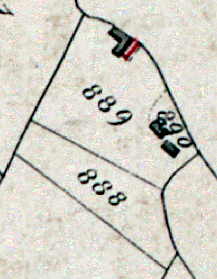
Before starting to unravel the history of the site it is worth a brief aside to examine some of the detail on the 1842 Tithe Map. The map below shows a wider area that includes both Barter's Farm and Poundside, as well as highlighting the edge of Whiteparish Common separating the property from the road. Barter's Farm and a house to the north that is no longer there are shown as areas 889 and 890, each described as House, Garden and Orchard, with the ownership shared by James Barter and Levy Chalk. The map shows 889 as a much smaller plot than 890, but the both are listed as an area of 2 poles and 20 perches (0.625 acres or 0.25 hectares). Plot 889 and 890 together measure roughly 0.65 acres and within it 890 is about 0.1 acres on a modern map, which leaves a puzzle: did they declared the same area twice for the Tithe Award, or was this an error?
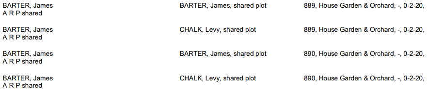
1842 Tithe Award entries for 889 and 890, each shared between James Barter and Levy Chalk
 .
.
.gif)
.gif)
LEFT: 1842 Tithe Map
CENTRE: Annotated tracing
RIGHT: Aerial view marked up over modern landscape (approximate and being worked on to refine boundaries)
The maps below show the development of buildings on the site and suggest that the house may already have there by 1842, notwithstanding later alterations or rebuilding. The 1842 Tithe Map is shown on the left alongside an annotated tracing. Three of the four buildings shown are also on the next (1876) map, on which the red coloured buildings are the houses, grey ones being farm buildings. The Tithe map generally follows the same colour system and as 890 is described as house and garden, one of the two buildings should presumably have been coloured red. The house is likely have been the northern one of the pair to match the 1876 map. Following this onto the next map of 1900, the house is then shown with a rear extension and with a well alongside. Other nearby buildings are no longer there at this date, presumably replaced by a farmyard shown to the south. In 1876 and 1900 the field labelled 888 has been incorporated into the plot, as well as part of 893, and the 1900 map shows new farm buildings added to the south on the 893 part of the plot. The tree symbols used on the two later maps indicate the continued presence of the orchard. We know from Cottage Farm to the north that growing and selling apples was undertaken locally, in that case on the site now occupied by The Bramleys, and this orchard may likewise have been commercially exploited.

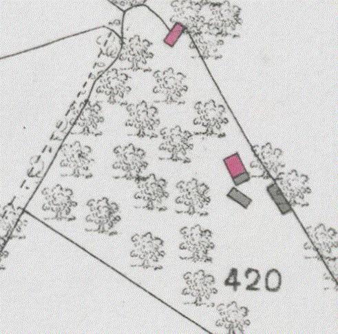
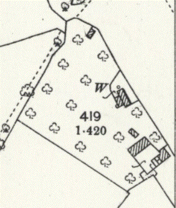
The Barter's Farm buildings in 1842, 1876 and 1900
From left to right: 1842 Tithe map; labelled tracing (from 'Barters - WP Garage - Poundside.odg'); in 1876; in 1900
On the next (1924) map the house is unchanged from 1900, still with the well indicated, while the 2022 map shows the modern layout of buildings, including the improvements and changes made in 2003. See working notes for full details of these improvements and for further research being carried out into this area. In following details across this pair of maps, note that the yellow area corresponds to the areas shown in 1924 as 418 and 419, as well as the next area southwards where the .349 acres is marked. The 2022 area shown grey is now Whiteparish Garage.
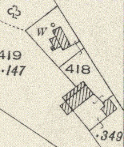
The Barter's Farm buildings in 1924 and 2022